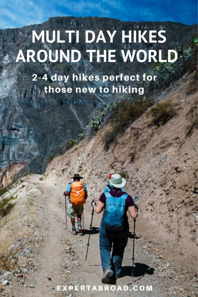
Multi-day hikes are a great way to really get to know a place. If you have thought about doing a long hike but not sure if you are up to it these hikes are a great way to get a feel for distance walking.
I asked some of my blogging mates to share their favourite walks with us to inspire us to lace up the hiking shoes and get moving in 2020.
What you will find here
Multi-Day Hikes In Australia & New Zealand
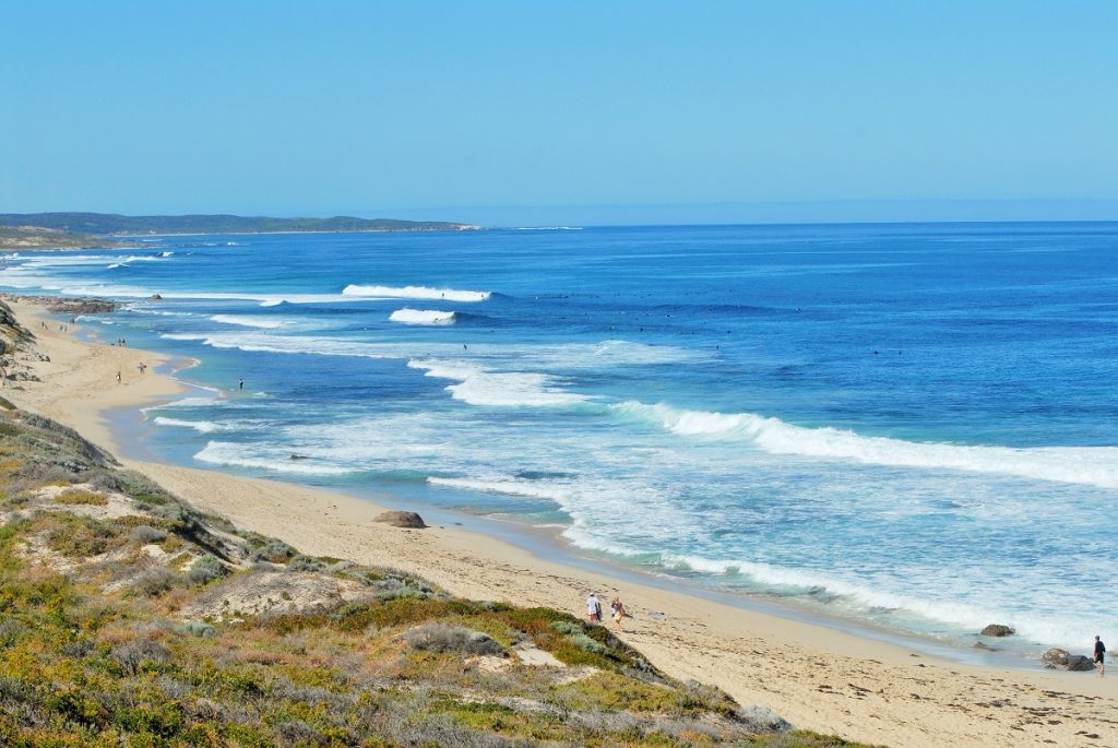
Cape to Cape Trail, Southwest Australia
Nina Burakowski, West Australian Explorer shares a walk that is on the very top of our list of walks to do in Australia.
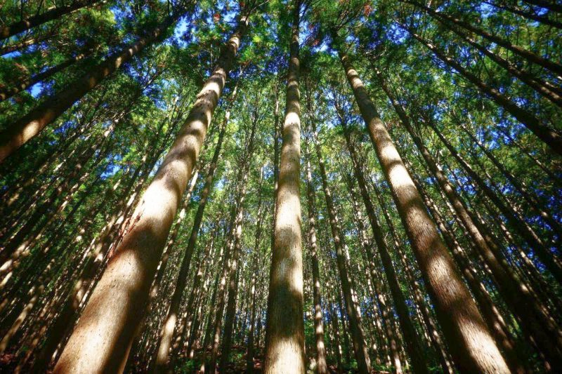
The Cape to Cape Walking trail is a multi-day hike located in Australia’s southwest region and is Australia’s longest coastal walk. The trail is 135 km long and spans from Cape Naturaliste in the north, near the town of Dunsborough to Cape Leeuwin in the south.
This incredible Australian hiking trail passes through the famed Margaret River region with magnificent coastal and forest scenery. The many highlights of the Cape to Cape trail include the region’s rugged beaches, sea cliffs, towering Karri trees and seasonal wildflowers.
The trail takes between 5-7 days to complete end to end. There are 4 campgrounds situated along the trail. These provide wooden table and benches, rainwater tanks and eco toilers and can be used as overnight. The trail is designed for walkers to pass through regional towns including Yallingup and Prevelly near Margaret River. These have plenty of accommodation options and provide an opportunity to stock up on supplies.
The Cape to Cape Trail is rated as a moderate walking trail. There are no steep hills and the terrain is mostly flat. The main challenge is walking on sandy terrain and there are several beach stretches along the way where the sand can get quite soft.
The best time to walk the trail is between April and September to avoid the summer heat. Although the winter months can get fairly wet and cool.
You can find out lots more about the wonders of Western Australia on Nina’s Facebook page Western Australia Explorer
This post may contain affiliate links. If you book via these links, we may make a small commission at no extra cost to you.
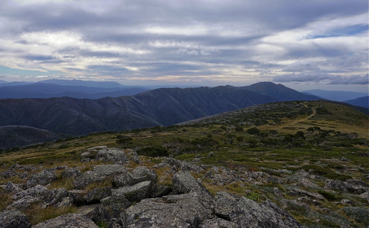
The Razorback
Jean Cheney Traveling Honeybird is based in Melbourne Victoria and while she has experienced some amazing hikes in Nepal today she is sharing one that is a little closer to home.
2 days hiking, or if you are keen a one-day trail run, out and back. Named so because of the high and narrow ridgeline between Mt Hotham and Mt Feathertop, the second-highest in Victoria. The hike along the Razorback also sets it up as arguably one of the most scenic hikes in Victoria.
The hiking track stays mostly high along the ridgeline and alternates between snow gum forests and high alpine grasslands. The views over the Ovens Valley to Mt Buffalo in the West or to the Bogong High Plains and Mt Bogong itself to the east side on a clear day are breathtaking.
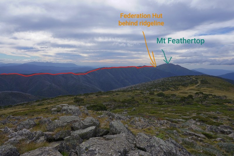
Starting at Diamantina Hut on the Alpine Road near Hotham Resort you follow the razorback north towards Mt Feathertop to Federation Hut. The extra side track up to the summit of Mt Feathertop is well worth the effort on a clear day.
The amount of vertical distance is minimal compared to other hikes in the area making it a good beginner to intermediate hike in summer months. However, the exposed terrain and the fast-changing weather in that area means adequate clothing for any weather and having at least one person in the group with reliable navigation skills is a must…it can and has snowed there in summer and it can go from clear skies to a whiteout in minutes.
In snow season the Razorback changes and becomes a place only for the experienced hiker or snow sports person with the added risks of steep snow and ice, and avalanche danger.
There is plenty of sheltered space around Federation Hut for tents, the hut can get a little crowded around dinner time but also quite sociable on a busy weekend. The hut is primarily for emergency refuge and not to be slept in. Nearest water in dry times is a 20min walk further down the Bungalow Spur (towards Harrietville) from the hut.
You can follow Jean’s adventures on her Facebook page
Related: Check out some great walks in Melbourne
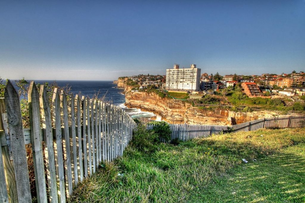
Bondi to Manly Walk
This brand new 80km trail was opened in Sydney late last year. While it has recently been covered in just one day by a friend of mine completing it in 16 hours at speed, the usual way to tackle this walk is to split it into three or four days.
We have even written up instructions to cover it over 7-10 days if you don’t want too much of a challenge.
Covering ocean beaches, sandstone cliffs, quiet harbour bays, pristine bushland and Sydney’s biggest icons the Harbour Bridge and Opera House this walk does not disappoint in views.
You can choose a single base and head out to your starting point each day or choose accommodation along the route and carry your belongings with you.
This is a city walk so you are never too far from civilisation. It’s a lovely way to experience Sydney and still be about to head out in the evenings if you have the energy.
Multi-Day Hikes in Asia
Kumano Kodo – Japan
Wendy Werneth from the Nomadic Vegan shares a walk Charlie and I hope to do in the next couple of years.
The word “kodo” in Japanese means “old ways”, and the Kumano Kodo is a network of ancient pilgrimage trails on the Kii peninsula, a beautiful mountainous, forested area south of Kyoto. The routes lead to the three most important Shinto shrines in Japan, collectively known as the Kumano Sanzen. Walking these trails is like stepping back in time, as you are literally walking in the footsteps of emperors, aristocrats and samurai warriors who made the pilgrimage 1,000 years ago or more.
Since the Kumano Kodo is not one single trail but a series of trails, the pilgrimage can last anywhere between two and eight days. An ideal three-day version would be to walk from Takijiri-oji to Takahara on day one, Takahara to Tsugizakura-oji on day two, and on day three make a big push from Tsugizakura-oji to Kumano Hongu Taisha, one of the three main shrines. That third day would be longer than the others, at about 22 kilometres, but it’s also possible to shorten it by catching a bus for part of the journey.
Accommodation is in traditional Japanese guesthouses called minshuku, where you sleep on futons laid out on tatami mats. These guesthouses do fill up quickly, so be sure to reserve well in advance.
If you have a fourth day up your sleeve, you could soak your weary muscles in the hot springs at Yunomine Onsen, which is just 50 minutes’ walk from Kumano Hongu Taisha. There are several guesthouses in the town with attached hot spring baths, but the best one by far is Tsuboyu Onsen, a tiny wood cabin that juts out over the river to create a private onsen big enough for just one or two people. Relaxing here is the perfect finish to the Kumano Kodo walk!
Follow more Nomadic Vegan adventures on Wendy’s Facebook page
Kalaw to Inle Lake – Myanmar (Burma)
Emily from Wander-Lush says this walk might be one of the harder ones on our list. ‘It’s tough-going in parts, but the scenery makes the hard slog more than worth it.”
The hike from the small town of Kalaw to Inle Lake is one of the most popular trekking routes in Myanmar (Burma).
There are several variations of the trek suitable for different fitness levels. We did the longest hike, the 3-day 2-night version, which takes you all the way from Kalaw to the bottom of the lake. The trek starts out by summiting a hill on the edge of town for beautiful views back over Kalaw. Heading east through remote Shan State, the path leads through cornfields, along buffalo trails and through tiny villages. Accommodation is provided along the way in either homestays or bungalows custom-built for tourists. Every time you hit a village, you stop for a cup of tea (mandatory) and a water refill.
There are no particular points of interest along the way, just epic views of the Shan tea fields and mountains beyond. If you’re lucky, there might be a religious festival or celebration happening in one of the villages, in which case tourists are usually more than welcome to join in.
For the most part, the terrain is smooth and easy to manage with sneakers. There are some uphill jaunts, but a large portion of the walk is flat. If you are there in summer, remember to bring sun protection gear as much of the track is unshaded. Catching your first glimpse of the shimmering Inle Lake on the final day of the trek is a very satisfying feeling! The hike ends at the southern tip of the lake, where you jump in a wooden boat for the 90-minute journey up to Nyaungshwe.
There are half a dozen agencies in Kalaw that offer trekking packages. Depending on the season, you can usually organise something on the fly a few days in advance. An English-speaking guide will accompany you on the trek and set the pace. The cost is split, so if you can join a group or find other travellers to team up with, it will work out cheaper for everyone. You can organise to have your bags transported to Kalaw – they will be there waiting at your accommodation when you arrive.
Check out Wander-Lush on Facebook for more of Emily’s trips.
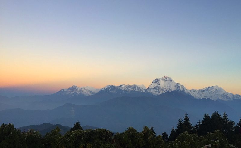
Ghorepani, Poon Hill – Nepal
Millie from Amateurist Advice has some pretty solid tips for walking in Nepal for those ready to up their game a bit.
Trekking in the Himalayas is no easy feat. This is why the trek to Ghorepani, Poon Hill is so special. Poon Hill is 3210 metres above sea level (masl). In comparison to other treks in Nepal, this is one of the most accessible. The altitude is not as high as the more popular Everest or Annapurna Base Camp Trek. It’s also a short 3-4 day trek which affords you one of the most stunning views of the Himalayas.
Poon Hill Itinerary
The Poon Hill trek starts in the beautiful lakeside city of Pokhara. There are regular flights and buses from Kathmandu to Pokhara. From Pokhara, it’s a 1-2 hour taxi ride to Nayapul, a small village set at 1100 m. Here you must check-in and show your ACAP (Annapurna Conservation Area Permit) and (TIMS) Trekking Information Management System Permit. If you go with a guide, they will take care of everything for you.
The first day of the trek starts on a calm flat trail before steeply climbing up to Ulleri. There are plenty of teahouses along the way. Teahouses are basic lodging, usually run by a family. This is where you can have lunch or spend the night.
The second day of the trek is difficult. The trail starts in Ulleri all the way to Ghorepani 2800 m. There are a lot of stairs on this day but it’s worth the effort. From Ghorepani, the views of the snow-capped mountains are already visible.
The following day is an early start. Wake up call is at 4 a.m. in order to catch the sunrise in Poon Hill. It will be pitch dark as you hike up from Ghorepani to Poon Hill 3210 m. It might be harder to breathe as you gain elevation. But you’ll feel better once you reach the top.
At sunrise, the sky slowly changes into shades of dark orange, pink and purple. It reveals the snow-capped mountains of the Annapurna region. All trekkers and guides stand amongst the prayer flags in awe of the view. Though it’s tempting to snap a million photos, try and find a moment to just gaze upon the mountains with your own eyes.
Afterwards, you’ll head back down to Ghorepani for a well-deserved breakfast. From here, it’s possible to hike all the way down, catching a bus from Birethanti to Nayapul. From there Pokhara is just a taxi ride away. Another option is to stop at Tikhedunga or Ulleri one more time, before heading back to Nayapul.
After witnessing the beauty of the Himalayas, you may want to extend your time and continue onto the Annapurana Base Camp trek. Whichever road you choose, you will always have the memories of gazing at the Himalayas as the sun lights up the mountains. This is why we hike.
You can find Millie over on her Facebook Page if you have any questions about this walk.
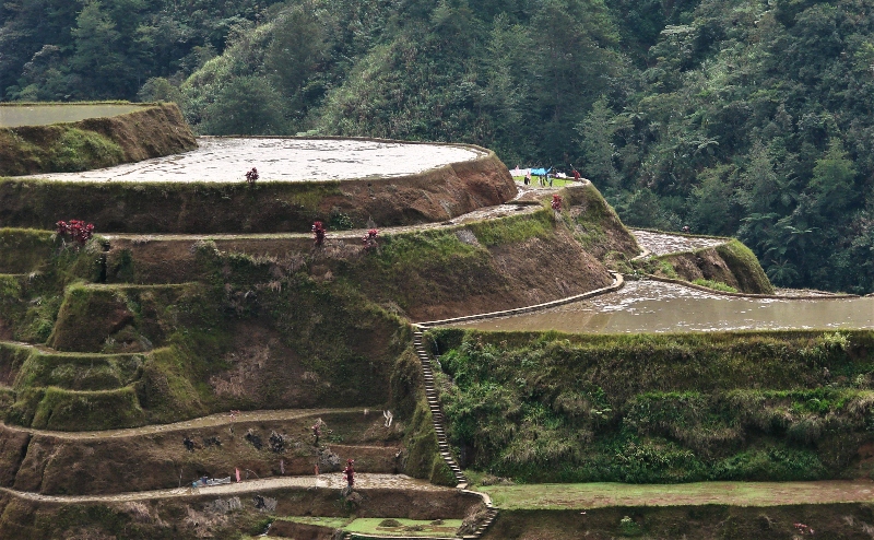
Batad rice terraces – Philippines
Lotte Eschbach from the Phenomenal Globe Travel is lucky enough to have experienced walking the 2000-year-old Batad Rice Terraces and shares her tips with us.
Why it’s special
This hike is unique because you’ll be off the grid for three days and feel like time has stood still. Hiking through the 2000-year-old Batad rice terraces, which have been carved by hand, is a humbling experience and a tribute to the inventiveness of the Ifugaos. It was the most memorable activity of our three week Philippines itinerary and that says a lot since we also visited stunning El Nido.
How long it is
This is a three-day hike, on the first day you will hike for approximately 6 hours. The second day is around four hours of hiking and the third day is only three hours of hiking. Along the way, you’ll crisscross through the beautiful rice terraces, with help of a guide as it’s pretty much impossible to navigate the trail on your own.
Difficulty
While not extremely difficult, you will need a good level of fitness. The track ascends and descends and you need sure feet to walk the narrow tracks through the rice fields (or you’ll get your feet wet). It’s not a technical hike, you don’t need any specific equipment, just proper boots. Don’t do this hike in sneakers like I did, you need hiking boots as the track is often wet and slippery.
Key sites
While the star of the show is the Batad rice terraces, you will also come across the village Cambulo. This isolated village is a great place to learn more about the local way of life and see some traditional houses. Another highlight is the Tappiya waterfall, where you can go for a swim (or just dip your feed in the cold water).
Accommodation along the way
You will be sleeping in very basic accommodation along the way. In our homestay in Cambulo, there was a very tiny toilet with a bucket to flush and no shower. In Batad there was a shower but no flush toilet (a bucket works just fine). So don’t expect any luxury along this hike, it’s very basic but an amazing experience.
I always enjoy reading Lotte’s blog, if you like walking you might want to check out her guide to hikes in New Zealand that recently caught my eye.
Short Hikes in Africa
Tok Tokkie Trails
Claire from The Adventurous Flashpacker had me at eco-luxe, I mean what could be better. Well, an African nature reserve upped the ante even more and now I have another expensive holiday on my wishlist!
If an eco-luxe glamping hike through an untouched desert sounds like your idea of paradise, then you’re in luck with Tok Tokkie Trails . Tok Tokkie Trails is a 3 day, 2-night small group guided hike through the beautiful NamibRand Nature Reserve in Namibia. Namibia is renowned for its incredible desert landscapes, where the scenery is both endless and ever-changing.
Expect a hiking experience like no other, where your days are spent navigating grassy plains and gently undulating sand dunes, and your nights are spent dining on 3-course meals and star gazing from your outdoor bed. That’s right, you’ll be sleeping under the stars! But don’t let this put you off, as guests are treated to a cosy warm stretcher set up by the guides, complete with access to a hot bucket shower and outdoor toilet.
Tok Tokkie Trails is the perfect trek for novice hikers and can be tackled by anyone with a reasonable degree of fitness. The hike covers around 22km over one full day and two half-days of hiking, with a mix of flat terrain, small dunes and only one larger rocky hill. The pace is steady but not fast, and the guide will keep you entertained with information and stories about the lands you’re crossing. Keep your eyes peeled and, if you’re lucky, you may just spot some of the local residents from the striking oryx to the eponymous tok tokkie beetle. Whatever your idea of paradise, you’re guaranteed to leave Tok Tokkie Trails feeling refreshed, invigorated and at one with nature.
Follow more of Claire’s inspiring adventures over on her Instagram account
Multi-day Hikes in Europe
Maderanertal Valley, Switzerland
Annabel from Smudged Postcard took her family on a hike in Switzerland, I love the idea of introducing kids to hiking nice and early. Read on to see how it went.
Hiking in the Maderanertal Valley in the canton of Uri in Switzerland is a great option for families looking to introduce children to multi-day walks in a fun and undemanding way. The hike can be done over two or three days, depending on how long visitors want to spend swimming in the lake and admiring the scenery.
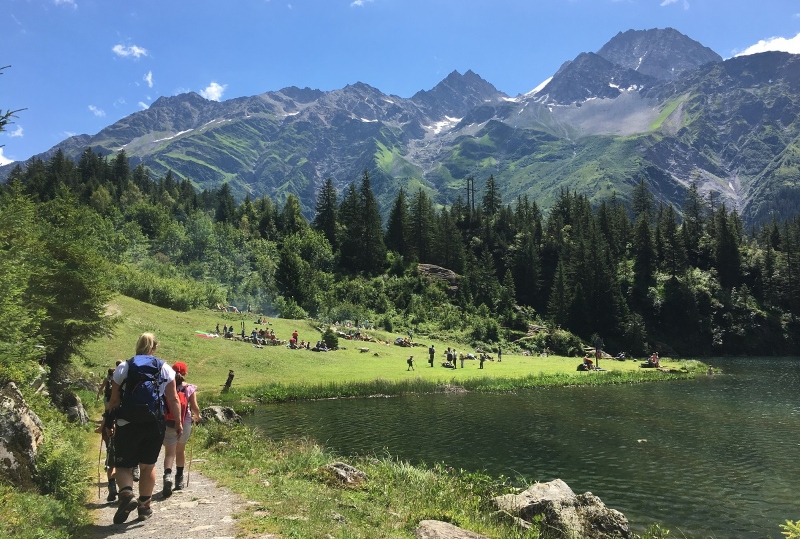
The walk begins with a cable car ride from Bristen up to Golzern. There are several guest houses at this little settlement and it’s a great destination for a picnic and a swim at nearby Golzernsee. The following day, the walk continues past the lake into dense forest with a descent to the River Chärstelenbach. There’s a dairy close by for lunch: cheese, meat, bread and yogurt before a gentle walk uphill to the rather majestic Maderanertal Hotel.
After a night enjoying the excellent hospitality at the historic Maderanertal, the walk retraces down past the dairy and then hugs the river back towards Bristen. There’s a delightful restaurant, Gasthaus Legni, towards the end of the hike which offers a rewarding lunch for weary walkers.
The scenery is spectacular throughout the hike and highlights for children include Lake Golzern and wild blueberry picking in the forests. There are no steep ascents on the walk so children as young as five should be able to complete it. The first day of the hike, as far as Lake Golzern, is buggy friendly. Both hotels offer family accommodation.
Follow more of the families travels via Instagram
Multi-Day Hikes in South America
Colca Canyon in Peru
Thea from Zen Travellers shares this walk which while not one for all beginners is not as hard as you may think. The route is easy to follow and you don’t carry your own pack so that helps.
Colca Canyon in Peru is a unique, beginner-friendly multi-day trek that is sure to delight.
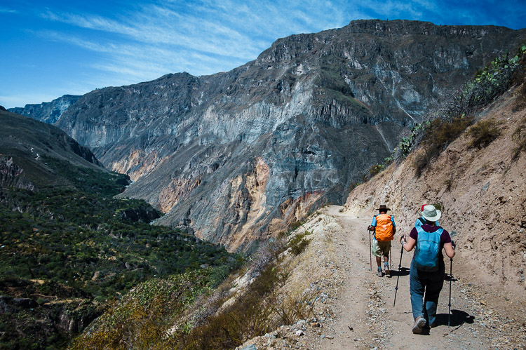
Located about 150km from Arequipa, Peru, a trek into Colca Canyon can be accomplished both with a guide or on your own. The trail is very clear and straightforward: down, down, down, on the first day; a leisurely jaunt through the canyon on the second day; and then a short but tough walk up on the third day. While it may be a challenge to climb up out of the canyon, the gorgeous sunrise will provide ample motivation and there is always the option to hire a donkey or a horse to make the trek out easier.
If you go the organized tour route, day one typically begins with an early morning drive from Arequipa with a stopover at Cruz del Condor which is a viewpoint to watch the majestic Andean condors soar by. Following that, you will arrive at Cabanaconde where you will meet your guide and begin the trek down to the river where you will spend your first night in one of the small cottages.
The following day is an easy walk to the Sangalle Oasis where you will pass through the small village at the bottom of the canyon where you can learn about the local culture in a small museum and take pictures of a charming stone church. Once at Sangalle, there are ample places to stay with swimming pools and cold drinks to relax the rest of the day away.
The last day starts early at 4:00am and involves a steep climb out of the canyon as the sun rises. The trip up takes 3-4 hours including lots of time for breaks. At the top, you can get a hot coffee and enjoy the spectacular views. If you’re on a guided tour, the trip back to Arequipa involves a relaxing soak in some hot springs and a stop at a viewpoint of Misti Volcano.
In all, a trek through Colca Canyon is a worthy one that will leave you with stronger legs than you started with and a greater appreciation for Peru’s natural beauty and diverse culture.
Head over to Zen Travellers Facebook page for more of their travels.
Stay tuned for Mr Experts very first post in coming weeks where he will dish the dirt on his Camino Francés that he completed last May.
Save these Multi day hiking trails to Pinterest

Have a question about something here? Want advice for planning your visit? Head to our Facebook page and we will do our best to help.
This blog is definitely rather handy since I’m at the moment creating an internet floral website – although I am only starting out therefore it’s really fairly small, nothing like this site. Can link to a few of the posts here as they are quite. Thanks much. Zoey Olsen
Write more, thats all I have to say. Literally, it seems as though you relied on the video to make your point. You clearly know what youre talking about, why waste your intelligence on just posting videos to your weblog when you could be giving us something informative to read?
What are Ageless Knees? Ageless Knees is a knee pain relieving program. Chris Ohocinski, a State-Licensed and Nationally Certified Athletic Trainer, came up with this program.
I have been absent for some time, but now I remember why I used to love this web site. Thanks, I will try and check back more often. How frequently you update your site?
Some really interesting points you have written.Aided me a lot, just what I was searching for : D.
obviously like your website however you have to take a look at the spelling on quite a few of your posts. Many of them are rife with spelling problems and I find it very bothersome to tell the reality however I’ll surely come again again.
What i don’t understood is actually how you are not actually a lot more smartly-appreciated than you might be now. You’re so intelligent. You already know thus significantly relating to this subject, made me individually imagine it from numerous varied angles. Its like men and women are not interested unless it is something to do with Lady gaga! Your individual stuffs nice. Always care for it up!
You made some nice points there. I looked on the internet for the issue and found most guys will consent with your site.
Good day! Do you know if they make any plugins to assist with Search Engine Optimization? I’m trying to get my blog to rank for some targeted keywords but I’m not seeing very good gains. If you know of any please share. Kudos!
I’d have to verify with you here. Which is not one thing I usually do! I enjoy reading a post that can make individuals think. Additionally, thanks for allowing me to comment!
I was very pleased to find this web-site.I wanted to thanks for your time for this wonderful read!! I definitely enjoying every little bit of it and I have you bookmarked to check out new stuff you blog post.
Hi, I think your site might be having browser compatibility issues. When I look at your website in Safari, it looks fine but when opening in Internet Explorer, it has some overlapping. I just wanted to give you a quick heads up! Other then that, fantastic blog!
Wow! This can be one particular of the most beneficial blogs We have ever arrive across on this subject. Basically Great. I’m also an expert in this topic so I can understand your hard work.
You have mentioned very interesting points! ps decent website.
It?¦s actually a great and helpful piece of info. I am happy that you just shared this useful information with us. Please keep us informed like this. Thank you for sharing.
Thanks for sharing superb informations. Your web-site is so cool. I am impressed by the details that you?¦ve on this website. It reveals how nicely you perceive this subject. Bookmarked this website page, will come back for extra articles. You, my friend, ROCK! I found simply the info I already searched everywhere and just could not come across. What an ideal website.
Enjoyed reading through this, very good stuff, regards.
Good write-up, I am regular visitor of one’s site, maintain up the excellent operate, and It is going to be a regular visitor for a lengthy time.
I have not checked in here for some time because I thought it was getting boring, but the last few posts are good quality so I guess I will add you back to my everyday bloglist. You deserve it my friend 🙂
Thank you, I have recently been looking for information about this topic for ages and yours is the greatest I’ve found out till now. However, what about the conclusion? Are you certain concerning the source?
Hi, Neat post. There’s an issue with your website in internet explorer, would test this?K IE nonetheless is the marketplace leader and a good portion of other folks will omit your wonderful writing due to this problem.
I like this website so much, saved to fav.
I’ve been browsing on-line greater than 3 hours as of late, yet I by no means discovered any attention-grabbing article like yours. It is pretty price sufficient for me. In my view, if all webmasters and bloggers made excellent content material as you probably did, the web will be a lot more helpful than ever before.
Hi, Neat post. There’s an issue together with your web site in internet explorer, may test thisK IE nonetheless is the marketplace chief and a good component to people will pass over your wonderful writing because of this problem.
Do you mind if I quote a couple of your articles as long as I provide credit and sources back to your blog? My website is in the exact same area of interest as yours and my users would definitely benefit from a lot of the information you provide here. Please let me know if this okay with you. Cheers!
Howdy, i read your blog from time to time and i own a similar one and i was just wondering if you get a lot of spam comments? If so how do you reduce it, any plugin or anything you can advise? I get so much lately it’s driving me mad so any help is very much appreciated.
What Is FitSpresso? FitSpresso is a dietary supplement that is made to support healthy fat-burning in the body
But wanna remark on few general things, The website design is perfect, the subject material is real good : D.
Thanx for the effort, keep up the good work Great work, I am going to start a small Blog Engine course work using your site I hope you enjoy blogging with the popular BlogEngine.net.Thethoughts you express are really awesome. Hope you will right some more posts.
Absolutely written subject material, thank you for entropy. “He who establishes his argument by noise and command shows that his reason is weak.” by Michel de Montaigne.
I love gathering useful information , this post has got me even more info! .
Thanks for some other informative site. The place else may I get that type of info written in such an ideal means? I’ve a challenge that I’m simply now working on, and I’ve been on the look out for such information.
Howdy very cool web site!! Man .. Excellent .. Wonderful .. I’ll bookmark your site and take the feeds also…I’m glad to search out so many helpful information right here within the publish, we want work out more techniques on this regard, thank you for sharing. . . . . .
Very interesting information!Perfect just what I was looking for!
Hi! Do you know if they make any plugins to assist with Search Engine Optimization? I’m trying to get my blog to rank for some targeted keywords but I’m not seeing very good gains. If you know of any please share. Thanks!
he blog was how do i say it… relevant, finally something that helped me. Thanks
You are a very capable person!
You should take part in a contest for one of the best blogs on the web. I will recommend this site!
Some really nice stuff on this website , I enjoy it.
I like your writing style really loving this internet site.
very good publish, i actually love this web site, keep on it
I like this post, enjoyed this one thank you for putting up. “To affect the quality of the day that is the art of life.” by Henry David Thoreau.
Some really interesting points you have written.Assisted me a lot, just what I was looking for : D.
I conceive this web site has got some rattling great info for everyone : D.
We still cannot quite think I’m able to often be some checking important points positioned on your webblog. Our neighbors and i are sincerely thankful with your generosity as well as giving me possibility pursue our chosen profession path. I appreciate you information I became with the web-site.